|
| *****SWAAG_ID***** | 936 |
| Date Entered | 01/08/2016 |
| Updated on | 04/08/2016 |
| Recorded by | Tim Laurie |
| Category | Tree Site Record |
| Record Type | Archaeology |
| Site Access | Public Access Land |
| Record Date | 31/07/2016 |
| Location | Birkdale Common. Foxholes. |
| Civil Parish | Muker |
| Brit. National Grid | NY 84255 01916 |
| Altitude | 500m |
| Geology | Eroding Peat Mire with remnant hags (remnants of 1.5m deep blanket peat dissected by many branching gutters or deep channels formed by low energy sikes or seasonal streams). This extensive blanket peat mire has formed over millstone grit and sandstone strata of Late Carboniferous, Namurian Age. |
| Record Name | Muker CP. Birkdale Common. Fox Holes. Pine stump possibly humanly worked. Below 1-2m deep peat. |
| Record Description | Single fossil pine stump in situ on ground surface of an actively eroding gutter within an area of blanket peat which is 1-2m deep.The pine tree was of relatively slight diameter and was clearly stunted, close to the altidudinal limit of trees in this highly exposed location. This pine stump bears what appear to be the clear cut concave facets from a stone axe indicating that it has been humanly worked during prehistory for firewood. This interpretation is tentative and not yet confirmed.
Slight remains of thin-stemmed stunted birch are present at the base of some peat sections at Fox Holes.
No other pine stumps have been located here. This indicates that this tree stump is that of an isolated stunted pine tree located within a mainly treeless area, with some birch scrub but otherwise mainly open of trees. The underlying rock strata being sandstone is deficient in plant nutrients and any soil present would not have supported woodland except for scrub and very stunted trees. |
| Dimensions | See photos. |
| Additional Notes | Fossil pine is uncommon under peat in the catchments of the Ure and Swale whereas pine is relatively frequent elsewhere in Pennine Blanket Peats. This reflects the predominantly limestone strata of the Swale and Ure Catchments below 500m. Limestone soils support mixed deciduous woodland. To the south, Nidderdale has more sandstone at both high and lower levels.
The rapid onset of Peat formation and probable Age of this Pine Stump across the Pennine Uplands. The Boreal/Atlantic Transition:
The pine stump grows directly on the mineral soil below the base of the 1.5m deep blanket peat. This small tree was almost certainly overwhelmed by the initial onset and rapid growth of peat mires across the Pennine Uplands at around 5,500BC (7,500years ago). The onset and rapid growth of blanket preat across the Pennine Uplands at this time was initiated by climatic change- from a more Continental (warm and dry) climate to a more Oceanic(warm and wet)climate. This climatic change is termed the Boreal/Atlantic Transition.
The presence of one or more zones of very dark, highly humified peat which has lost all plant structure and so very different from the rapidly growing fibrous peat marks periods of dryness with no peat growth and with drying out of the peat surface.
References: Sir Harry Godwin. 'History of the British Flora.' Second Edition 1975. Cambridge.
Reference:Tallis, J.H. 1983. ‘Forest and Moorland in the Southern Pennine Uplands in the mid Flandrian Period’. Journal of Ecology, Vol 71.
|
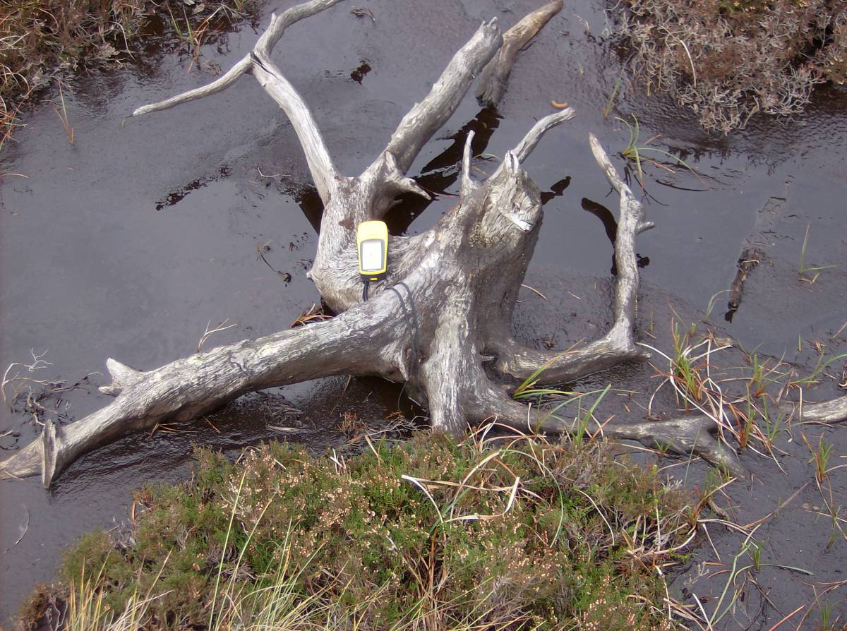
| Image 1 ID | 6801 Click image to enlarge |
| Image 1 Description | Muker CP. Birkdale Common. Fox Holes. Isolated stump of a stunted Scots Pine Tree at base of 1.5m deep blanket peat. | 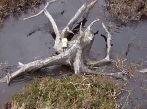 |
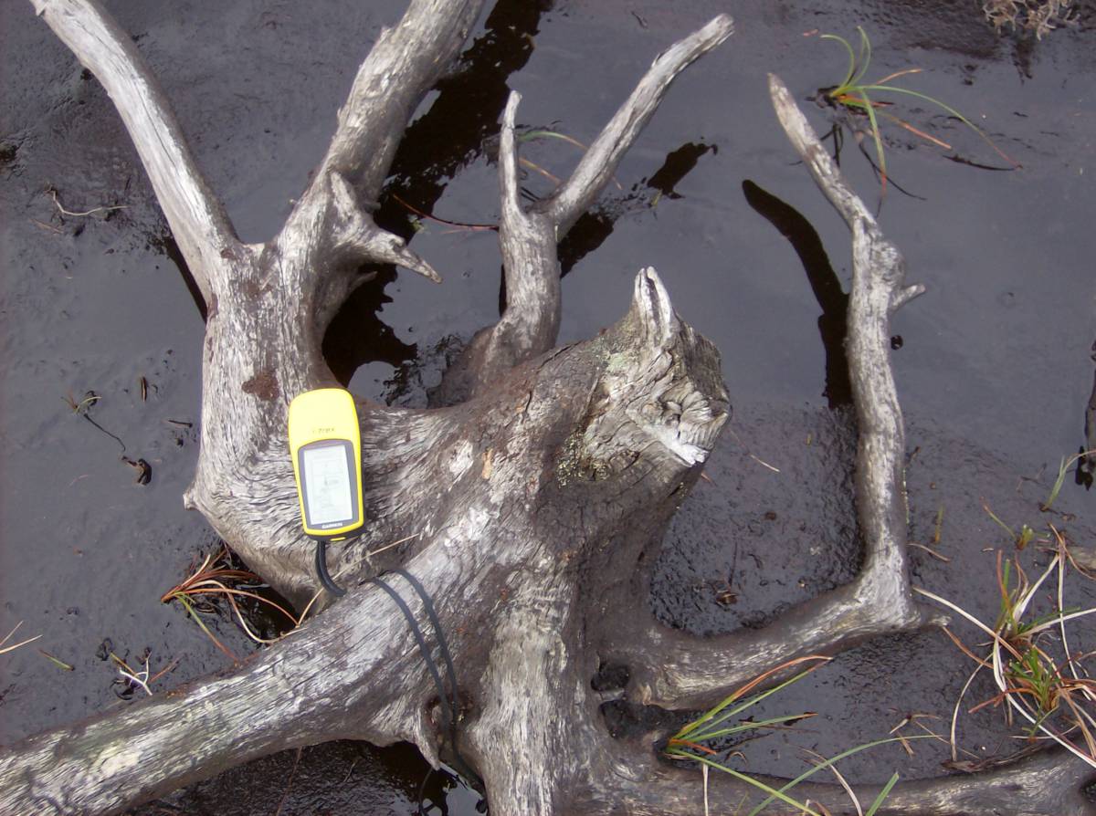
| Image 2 ID | 6802 Click image to enlarge |
| Image 2 Description | Detail of this pine stump showing possible axe cut facets. Photographed when first recognised in April 2002. | 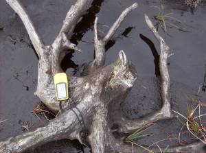 |
| Image 3 ID | 6803 Click image to enlarge |
| Image 3 Description | This pine stump is located at the base of the peat within a Gutter or active erosion channel. | 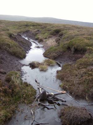 |
| Image 4 ID | 6804 Click image to enlarge |
| Image 4 Description | This pine stump is located at the base of the peat within a Gutter or active erosion channel. | 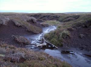 |
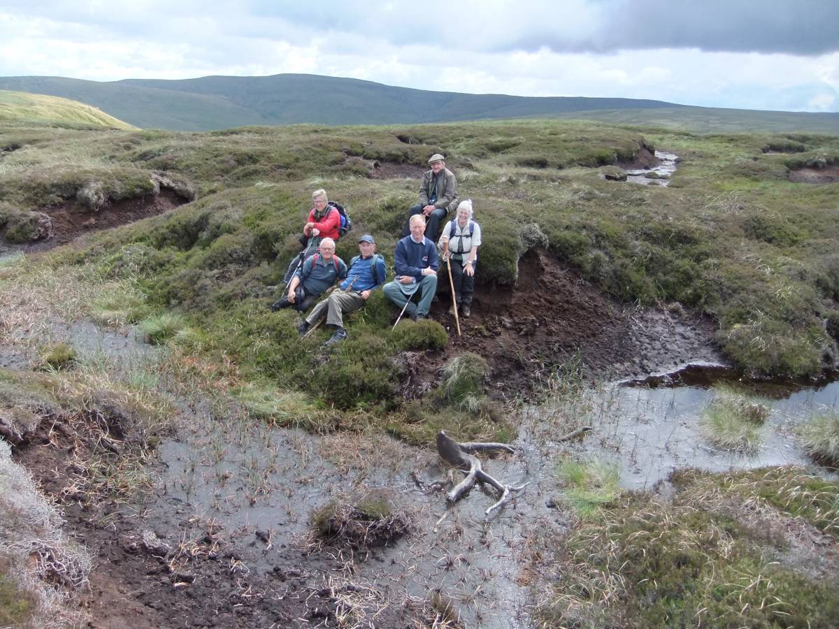
| Image 5 ID | 6805 Click image to enlarge |
| Image 5 Description | A recent visit by SWWAG members to the Foxholes Scots Pine Tree stump. | 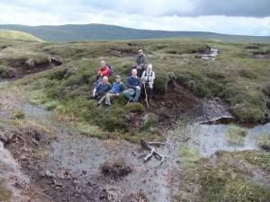 |
| Image 6 ID | 6806 Click image to enlarge |
| Image 6 Description | The direct GPS approach to the Foxholes Pine Tree from Birkdale Tarn directed by Mike Walton was the across these peat hags. | 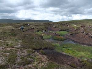 |
| Image 7 ID | 6807 Click image to enlarge |
| Image 7 Description | Foxholes peat hags. | 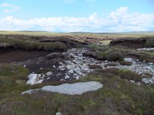 |
| Image 8 ID | 6808 Click image to enlarge |
| Image 8 Description | Foxholes peat Hags. |  |